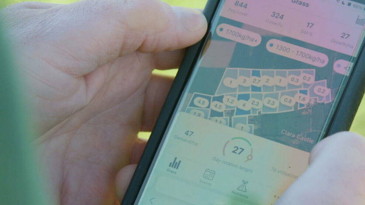
Knowing when your fields are an optimal length for grazing is crucial for grassland farmers or ranchers. Satellites may be the best way to get that information.

There’s a sweet spot of the grass growing stage you want to hit in terms of timing for grazing. Soon, farmers will be able to find that crucial time with help from satellites.
A new in-app remote-sensing technology launching later this year in Ireland will allow farmers to accurately measure the height of grass in their grazing paddocks from space. Satellite data will assist Origin Digital’s service GrassMax in providing users precise information about their fields, which program founders hope will lead to increased productivity and profitability for farmers.
The sweet spot for grass is when it has sprouted three offshoots, called the three-leaf stage, says Kieran Holden, grassland digital specialist at Origin Enterprises. This optimizes fuel for the animal, which influences how much meat they produce, and has a huge impact on farmers’ profitability.
“That’s when there’s an optimum amount of energy in the grass; it’s when there’s an optimum amount of fiber in the grass and there’s an optimum amount of protein in the grass,” says Holden.
Measuring grass has become a common tool for efficient grazing rotation in places such as Ireland, where grass-fed dairy is a big industry. Strategies for measuring grass range from the cut-and-weigh method to using plate meters to walking the field and taking stock of the grass by eye. These methods help calculate the dry matter available, which gives farmers an idea of how much feed is in the field.
Still, all of these methods take time. Walking your fields takes a few hours each time you do it, says Holden, and it can be inconsistent. Holden says this technology enables more efficient use of resources, serving to be more economically and environmentally sustainable.
In collaboration with Aspia Space, Origin Digital is using synthetic-aperture radar (SAR) satellite data to measure grass. SAR is a remote sensing tool that creates an image using radio waves. For grass-measuring purposes, this is preferable over camera imaging because it can overcome visual obstacles presented by weather.
“Lots of grass needs lots of rain, and where you have lots of rain, you have lots of clouds, and where you have lots of clouds, you have an issue with optical sensors,” says Holden. The satellite data will work in conjunction with other in-app technology such as weather-based growth models to create an accurate picture of grass in a farmer’s paddock.
Expanded access to satellite data means that a lot of industries are finding creative uses for it—especially when it comes to land management. Data collected by satellites are now used to map ghost forests and understand changes in sea-level rise. The National Park Service even uses satellite imagery to monitor landscape changes in some of its parks. Agriculture is no exception.
Last year, Planet and Organic Valley completed a pilot program using satellite imagery to evaluate pasture health in service of regenerative rotational grazing. The US Department of Agriculture recently funded research using satellite data to evaluate climate smart adaptations in agriculture, and the US Senate is considering a bill that would make precision agriculture, a practice involving technology such as satellites, available to more rural farmers. Agriculture technology has grown leaps and bounds over the last generation, says Holden.
“We have a small farm at home as well. My father initially started off plowing with a horse, and here we are talking about using satellite data to measure grass at home. It’s amazing what happens in a short space of time.”
This is preferable to using a camera for measuring grass since it can get beyond weather-related visual obstructions. To accurately depict the grass in a farmer’s field, the satellite data will be combined with technology from other applications, like weather-based growth models.
This innovative approach is a game-changer for farmers, providing accurate, efficient, and sustainable management of grasslands. The use of satellite imagery, especially with synthetic-aperture radar (SAR), is ingenious as it overcomes the limitations of visual assessments under varying weather conditions. The broader implications for land management and agricultural practices are immense, showing how far we’ve come from traditional methods to high-tech solutions that can significantly impact productivity and environmental sustainability.